


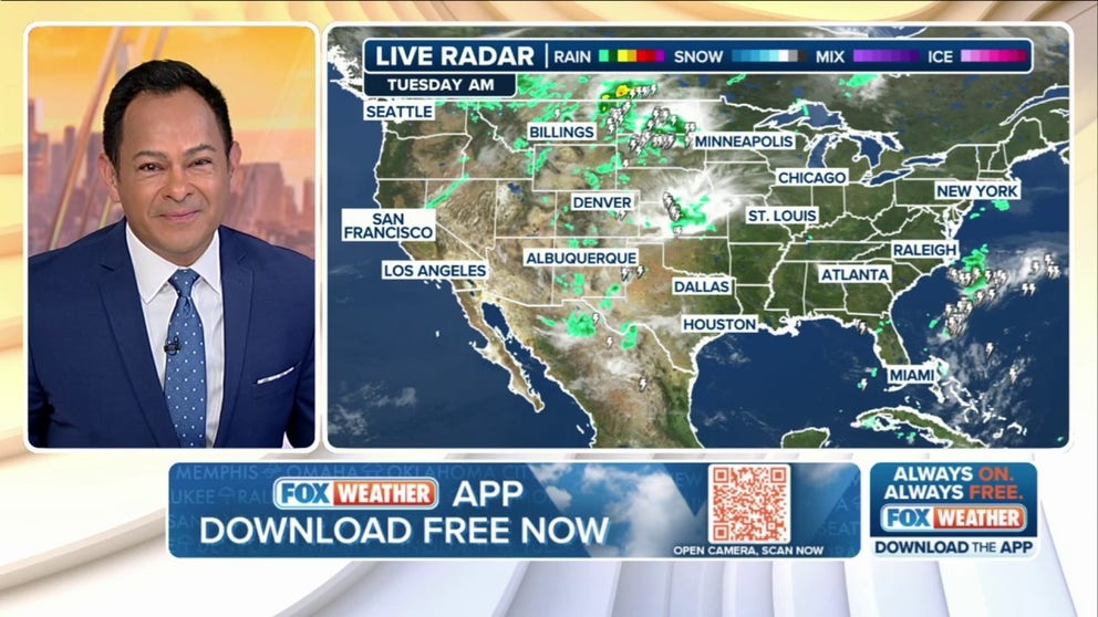
FOX Weather has you covered with the breaking forecasts and weather news headlines for your Weather in America on Tuesday, July 22, 2025. Get the latest from FOX Weather Meteorologist Craig Herrera.
Welcome to the Daily Weather Update from FOX Weather. It’s Tuesday, July 22, 2025. Start your day with everything you need to know about today’s weather. You can also get a quick briefing of national, regional and local weather whenever you like with the FOX Weather Update podcast.
Tropical-like rain threatens beach, outdoor plans along Gulf Coast this week
Beach and outdoor plans in the Southeast could be in jeopardy this week as a stalled cold front combined with an influx of tropical moisture from the Gulf is increasing the risk of heavy rain and thunderstorms from Louisiana to Floridaraising concerns of flooding.
The FOX Forecast Center said the setup is like the one that spawned Invest 93L off the U.S. East Coast last week, but tropical development this time around is unlikely at this point.
Heavy rain due to tropical moisture will be possible from Florida to Louisiana, beginning Tuesday afternoon and continuing into Wednesday, especially along the Interstate 10 corridor from Tallahassee to New Orleans.

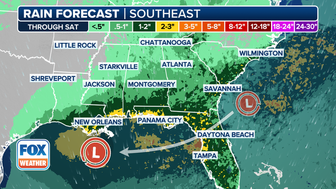
This graphic shows the forecast rain totals for the Gulf Coast through Saturday, July 26, 2025.
(FOX Weather)
Development window for Invest 94L closes
Meanwhile, Invest 94L, which was making its way to the Caribbean Sea, did not take on any tropical characteristics. While the atmospheric conditions were reasonably conducive for development, dry, dusty air nearby and hostile winds prevented Invest 94L from becoming tropical.
According to the FOX Forecast Center, long-range computer forecast models suggest that the Atlantic Ocean’s Main Development Region could become active once again with more tropical disturbances. Usually, this region comes to life in August, so hurricane season is proceeding as expected in the Atlantic Basin.
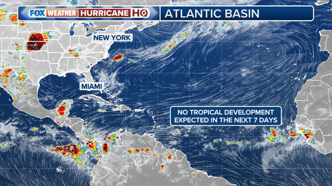
This graphic shows that no tropical development is expected in the Atlantic Ocean’s Main Development region over the next seven days.
(FOX Weather)
Life-threatening heat dome intensifies as ring of fire storms rumble across central US
The big weather story this week is a large area of high pressure building over the central U.S.often called a “heat dome,” the FOX Forecast Center warns.
While this particular heat dome won’t likely break any records, it will push temperatures into the upper 90s for a huge portion of the country.
This creates a setup where storms will fire up along the northern and eastern edges of the dome throughout the workweek. These “ring of fire” storms are powered by daytime heat and plenty of unstable air. They can bring damaging windslarge hail and heavy rain. If storms stall over the same area, flash flooding can happen, especially in places that have recently flooded.
Watch: 300-pound turtle freed after getting stuck between massive rocks on Florida beach
A photographer came upon a startling sight last Wednesday, when she discovered a 300-pound loggerhead turtle wedged between rocks on a southeastern Florida beach.
The incident occurred near the House of Refuge, where photographer Suzanne Cosme, owner of DeVine Portraits, had visited to take photos of the sunrise.
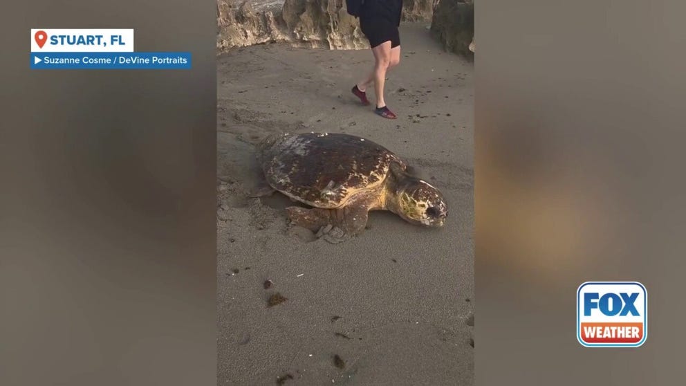
A photographer came upon a startling sight on Wednesday, when she discovered a 300-pound loggerhead turtle wedged between rocks on a southeast Florida beach.
Before you go
Here are a few more stories you might find interesting.
Need more weather? Check your local forecast plus 3D radar in the FOX Weather app. You can also watch FOX Weather wherever you go using the FOX Weather app, at FOXWeather.com/live or on your favorite streaming service.


