


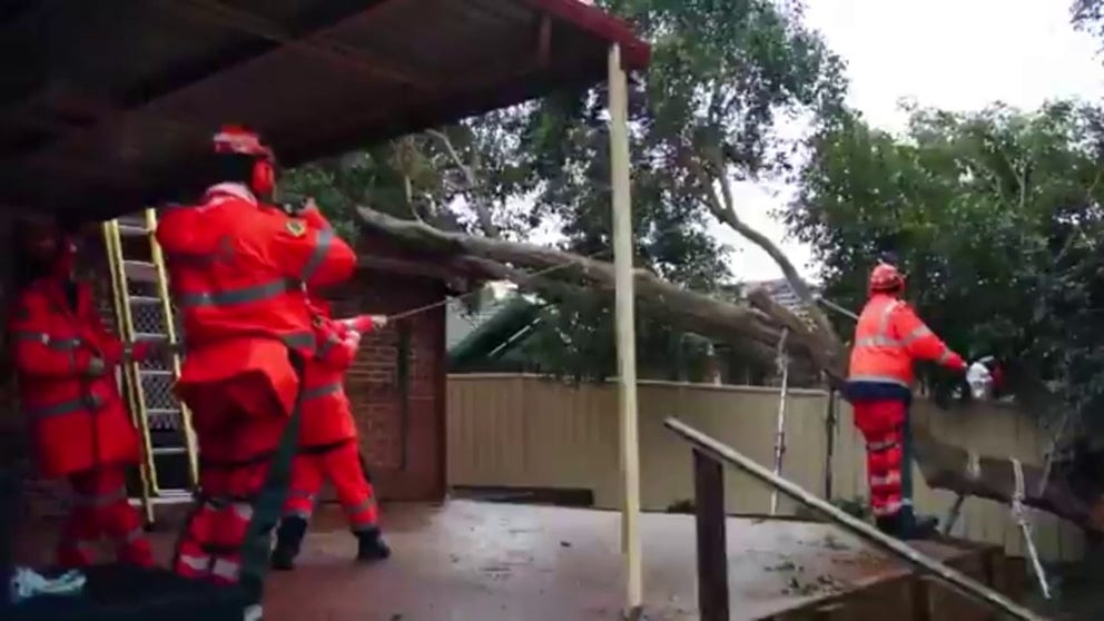
Video from emergency services in Australia shows the impacts a powerful bomb cyclone had on the region.
Sydney – A powerful bomb cyclone struck eastern parts of Australia during the first half of the week, triggering significant travel disruptions, flooding and downed power lines across several communities.
The storm system rapidly intensified into what meteorologists refer to as a “bomb cyclone” while north of the Tasman Sea.
Wind gusts of more than 70 mph and rainfall totals of more than 5 inches in some areas, led to widespread power outages and inundated roadways.
Ahead of the worst conditions, local emergency services issued evacuation warnings for low-lying coastal areas and communities near rivers and streams.
Early estimates indicated that more than 30,000 homes and businesses were left without power, with utility companies working around the clock to restore electricity and clear debris.
WHEN STORMS ‘BOMB OUT’: EXPLAINING HOW A BOMB CYCLONE FORMS
MYSTERIOUS OBJECT FOUND ALONG AN AUSTRALIAN BEACH THOUGHT TO BE A PIECE OF A SPACE ROCKET
“Our crews continue to respond to severe weather along the (New South Wales) coast, from the Mid North Coast to the Far South Coast,” emergency services stated in a public update. “In the past 24 hours, we responded to over 1,860 incidents in the Hunter, Sydney Metro, Illawarra, and South Coast. Flash flooding remains a key concern today.”
Air travel was also significantly impacted, particularly at Sydney’s main airport, where hundreds of flights were either delayed or canceled through Wednesday.
Passengers were advised to check with airlines or train operators before traveling.
Despite the damage, there were no initial reports of fatalities connected to the storm system, but authorities warned there would be an extended period of lingering effects.
Forecasters noted that abnormally warm sea surface temperatures along the eastern shore of the continent may have contributed to the storm system’s rapid intensification.
Satellite data shows water temperatures in the region have been trending 2 to 4 degrees above average, leading to more potential energy for weather systems.
In addition to the wind and rain, dangerous surf conditions are expected to persist along the coastline.

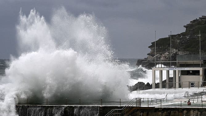
Large waves crash into the Bondi Baths and Icebergs Club at Sydney’s famous Bondi Beach on July 2, 2025, as large swells and high winds hit the east coast of Australia.
(Photo by SAEED KHAN/AFP via Getty Images / Getty Images)
HERE’S WHAT TO EXPECT IN THE TROPICS DURING JULY
Meanwhile, snowfall was expected across the eastern-facing mountain ranges above 4,000 feet.
According to Australia’s Bureau of Meteorology, July and August are typically the coldest months of the year as winter peaks across the Southern Hemisphere.


