


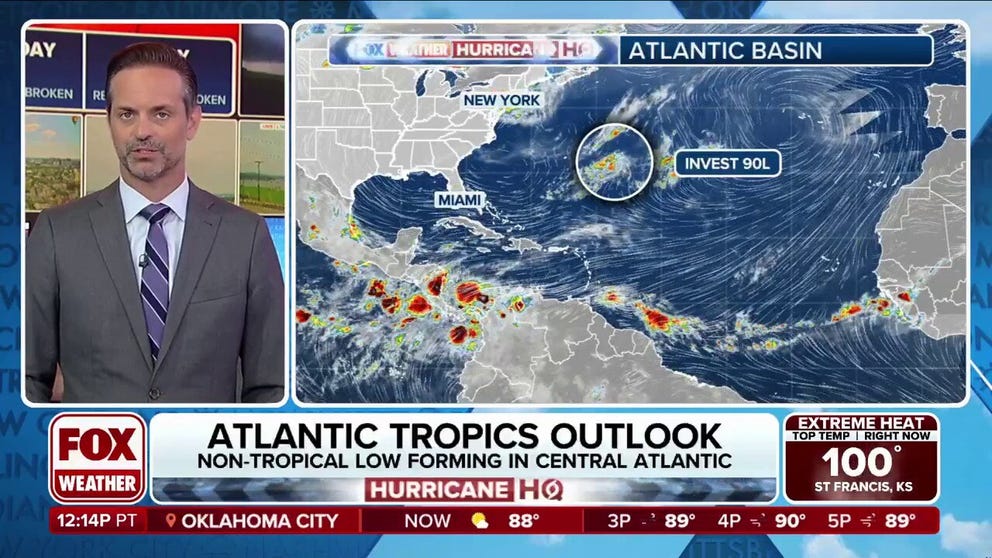
The National Hurricane Center (NHC) is watching a tropical disturbance in the central subtropical Atlantic dubbed Invest 90L, which was located some 450 miles east-southeast of Bermuda on Sunday afternoon. The NHC gives the system a low chance of development over the next two days.
The first three weeks of the Atlantic hurricane season have remained void of any tropical threats, but the National Hurricane Center (NHC) is now watching a tropical disturbance in the central subtropical Atlantic that continues to become better organized.
According to the NHC, showers and thunderstorms associated with an area of low pressure some 450 miles east of Bermuda were showing some signs of organization as of Sunday evening.
This system has been dubbed Invest 90L, which is a naming convention used by the NHC to identify areas it is investigating for possible development into a tropical depression or tropical storm within the next seven days.
WHAT IS AN INVEST DURING HURRICANE SEASON?
“Earlier satellite-derived wind data indicated the system possessed a well-defined surface circulation, and additional organization of the shower and thunderstorm activity could lead to the formation of a short-lived tropical depression over the next day or so,” the NHC said on Sunday evening.


(FOX Weather)
The NHC now gives Invest 90L a medium chance of development over the next two days.
This system is expected to encounter less favorable environmental conditions by Tuesday, ending its opportunity for further development.
Regardless of development, this system will not threaten any land areas as it moves northeastward at 5-10 mph across the open waters of the central Atlantic.
HOW TO WATCH FOX WEATHER
If the system were to develop into a tropical storm, it would receive the name Andrea. In an average season, the first named storm in the Atlantic forms around June 20.
The Atlantic hurricane season runs from June 1 to Nov. 30.


