


The Texas Hill Country could see additional thunderstorms Saturday, while over in the Southeast, a system that will soak Florida early next week could eventually get into some tropical mischief. FOX Weather Hurricane Specialist Bryan Norcross breaks it down:
FORT MYERS, Fla. — The “Sunshine” part of Florida’s state nickname is taking a break next week as forecasters instead watch for days of heavy rains and some potential for tropical mischief in the Gulf later in the week, now even catching the National Hurricane Center’s attention.
The culprit begins as a weak non-tropical area of low pressure that will move off the Southeast coast, across northern Florida, and eventually into the Gulf late next week, according to the FOX Forecast Center.

Potential tropics setup in Gulf of America next week.
With the system potentially spending multiple days over warm waters of the Gulf of America and the western Atlantic, the NHC says it will need to be watched for tropical development.
The NHC has just painted a broad area of the Gulf Coast from New Orleans through Florida and into the Atlantic off the Southeast Coast as an area they’ll monitor, though with just a low chance of development within the next 7 days.
“Environmental conditions could become marginally conducive for the gradual development of this system by mid to late next week as the system moves generally westward across the Florida Peninsula and over the eastern and north-central portion of the Gulf,” the NHC said. “Regardless of development, heavy rainfall is possible over portions of the Florida Peninsula and southeast U.S. coast through mid to late next week.”


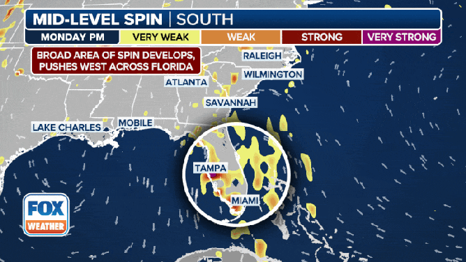
But before the storm even thinks of getting onto the National Hurricane Center’s plate, the slow-moving system is expected to drag several inches of rain across central and southern Florida, with the heaviest amounts forecast for Monday.
Overall rainfall totals for the week could reach 3-5 inches or more south of the Interstate 4 corridor. But some thunderstorms will have the potential to drop between 1-3 inches per hour, and pockets of flash flooding appear possible starting Sunday and continuing through midweek. Exactly where the best chance of storms and flooding sets up each day will become more apparent as the event gets closer.


It’s later in the week when the system enters the toasty waters of the eastern Gulf of America that attention turns to tropical development. So far, forecast models do not indicate a significant threat, but a handful of model runs do indicate the potential for development in the Gulf, the FOX Forecast Center says.
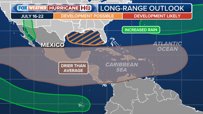
Tropical outlook for late July.
“You’ll note that little cinnamon bun swirl (on forecast model charts) that moved kind of right across the (Florida) Peninsula and into the Gulf,” said FOX Weather Meteorologist Michael Estime. “It’s that mid-level spin right there that we’re tracking that could – let me emphasize, could – by the time we get to this upcoming midweek, have some sort of tropical characteristics with it.”
Forecasters will be monitoring several factors that will determine the system’s ultimate fate, including the amount of wind shear present as the low heads into the Gulf, and how much time the system will spend soaking up energy from the warm waters.
“For now, we are in wait-and-see mode, with no credible threat to react to at this time,” the FOX Forecast Center said. “That said, it is a pattern worth watching, and watch it, we will.”
Three injured during St. Augustine Beach lightning strike
And the wet weather has already caused some problems in the Sunshine State.
St. Johns County Fire Rescue reported three people were injured Saturday afternoon when lightning struck the St. Augustine Beach Pier.
The agency said one person suffered critical injuries and was airlifted to a trauma center, while another person was taken to a local hospital with non-life-threatening injuries.
A third person was also reported to have been evaluated but refused medical transport.
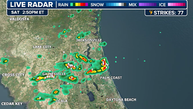
Lightning strikes St. Augustine Beach Pier on 7/12/2025
(FOX Weather)
The pier was closed after the incident, but there only appeared to be minimal damage to the structure.
First responders did not disclose whether the victims tried to seek shelter before storms moved through the nation’s oldest city.
The lightning strike came less than 48 hours after two teens were killed in Southeast Georgia while on a late-evening fishing expedition.


