


A coastal storm bringing rain and thunderstorms to portions of the East Coast won’t have too much of an impact, but the storm is expected to “bomb out” as it approaches Canada early this week. FOX Weather Meteorologists Britta Merwin and Haley Meier break down the latest forecast on Nov. 3, 2025.
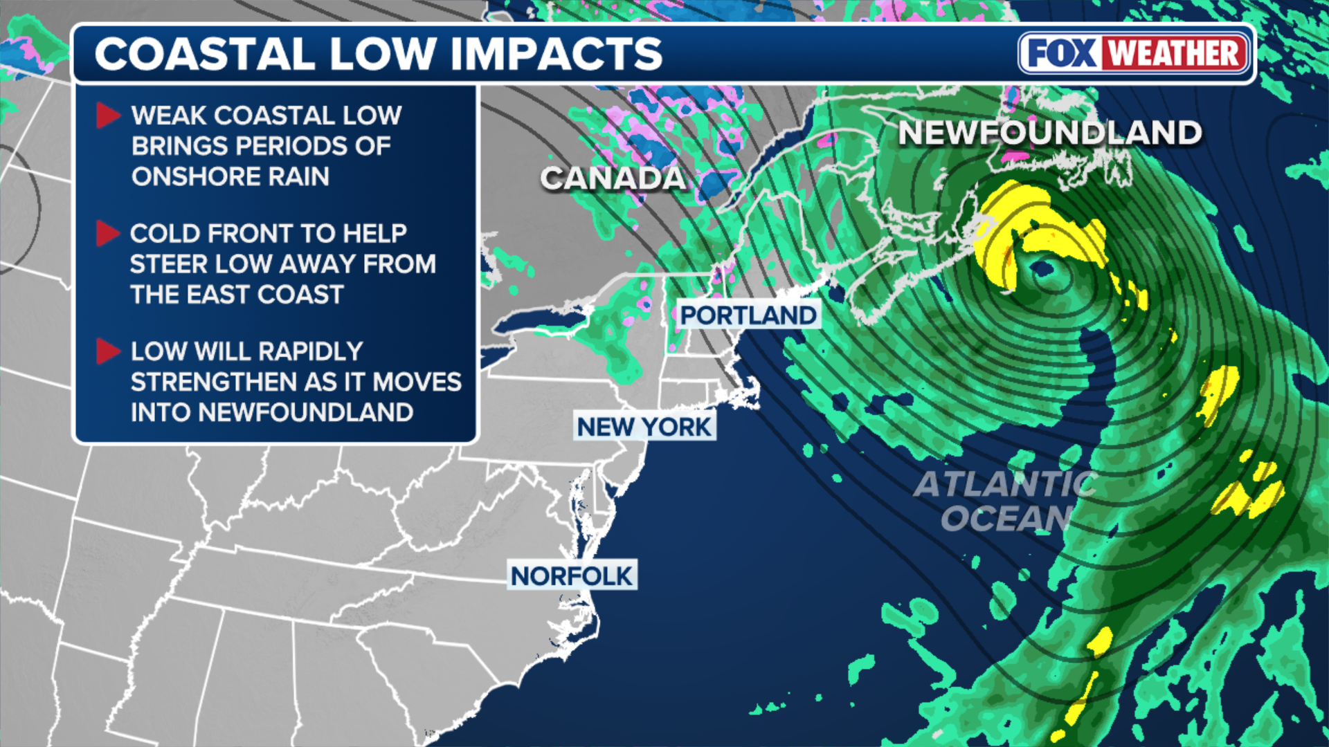
A weak coastal storm moving up the U.S. East Coast is bringing rain to portions of the mid-Atlantic and Northeast to kick off the new week, and while impacts are expected to be minimal, there could be some travel delays along parts of the Interstate 95 corridor as well as airports across the region.
The FOX Forecast Center said that the core of the system will remain safely offshore as it delivers light to moderate rain to communities along the East Coast from the Outer Banks in North Carolina to the Northeast.
HOW TO WATCH FOX WEATHER

(FOX Weather)
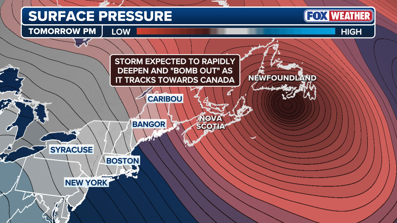
However, the low pressure system will eventually undergo “bombogenesis” as it sweeps toward Newfoundland, Canada.
Bombogenesis or “explosive cyclogenesis,” occurs when a storm system’s central pressure drops at least 24 millibars within 24 hours.
In this instance, the FOX Forecast Center believes the storm’s pressure could deepen from the upper 990s down to the 940s in less than 24 hours, which is extreme.
DOWNLOAD THE FREE FOX WEATHER APP


FILE: This image shows homes along North Carolina’s Outer Banks collapsing into the Atlantic due to the impacts of Hurricane Imelda.
(Jenni Koontz / EpicShutterPhotography via Storyful / FOX Weather)
As stated above, the impacts of this storm as it moves off the mid-Atlantic and begins its journey up the East Coast will be minimal. But residents living along the Outer Banks will be holding their breath, hoping no more homes become victims of the Atlantic.
More than a dozen homes have collapsed into the angry Atlantic Ocean in recent weeks due to relentless waves kicked up by passing hurricanes and nor’easters that have been pounding the coast.

Drone video shows waves and coastal erosion taking down another home in Buxton, North Carolina on Oct. 18.
The FOX Forecast Center said winds within this area of low pressure won’t be as strong as the system moves off to the north. Primary impacts for the U.S. will be gloomy, nuisance weather, which could lead to some travel delays at major airport hubs.
However, a few pockets of heavy rain may hang around the Outer Banks before quickly winding down by late Monday morning or early Monday afternoon.

A video shared from Buxton, North Carolina, shows workers and contractors trying to save a beachfront home from collapsing into the Atlantic Ocean on Oct. 30 after more than a dozen were destroyed due to relentless waves crashing onto the beach.
The bigger story will be impacts to Canada by Tuesday.
Steering this coastal storm will be a dip in the jet stream, which is part of a weaker clipper system.
As those two systems interact, the coastal low will be in a favorable position to rapidly deepen.

(FOX Weather)
The core of the coastal storm is expected to move directly into Newfoundland on Tuesday night with winds higher than 75 mph at the coast and periods of flooding rain.
Feet of snow will also be possible in the higher elevations.


