


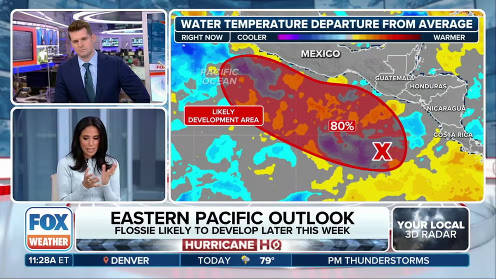
Invest 95E has a high likelihood of developing into a tropical depression or tropical storm, according to the NHC. If it becomes a tropical storm, it will be named Flossie.
Tropical Storm Andrea was easy to miss. From the time the National Hurricane Center gave the system a name until it was downgraded to a remnant swirl was only 12 hours. In retrospect, it probably should have been named a little sooner, and the stats will likely be adjusted in the post-season analysis.
In any case, the ‘A’ name is crossed off the list, and we wait for Barry.
The tropics continue in shut-down mode across the tropical Atlantic, the Caribbean, and the Gulf. High pressure is holding the storm track to the south. Saharan dust is surging. And the Atlantic tropical waters are still too cool to support development.

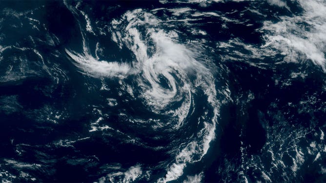
Tropical Storm Andrea, the first named storm of the 2025 Atlantic hurricane season, swirls across the ocean on June 24, 2025.
(NOAA)
Andrea developed from the remnants of an old front sandwiched between the heat-dome high over the eastern U.S. and another strong high over the eastern Atlantic. While the tropical ocean is somewhat cool, the water in the subtropical zone east of Florida and the Carolinas is quite warm. Andrea got a bit of a kick from the extra energy in the ocean east of Bermuda.
Even the long-range computer forecast models that extend out a couple of weeks show no development. Officially, the National Hurricane Center only forecasts for the next 7 days, but unless something inconsequential spins up in the middle of oceanic nowhere like Andrea, the quiet spell is likely to last longer.
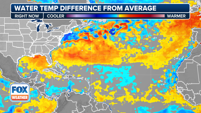
Current sea surface temperatures.
(FOX Weather)
Be grateful for the pause, but remember that what happens in June and early July tells us nothing about what will happen in late August, September and October. Be ready. Stay informed.


