


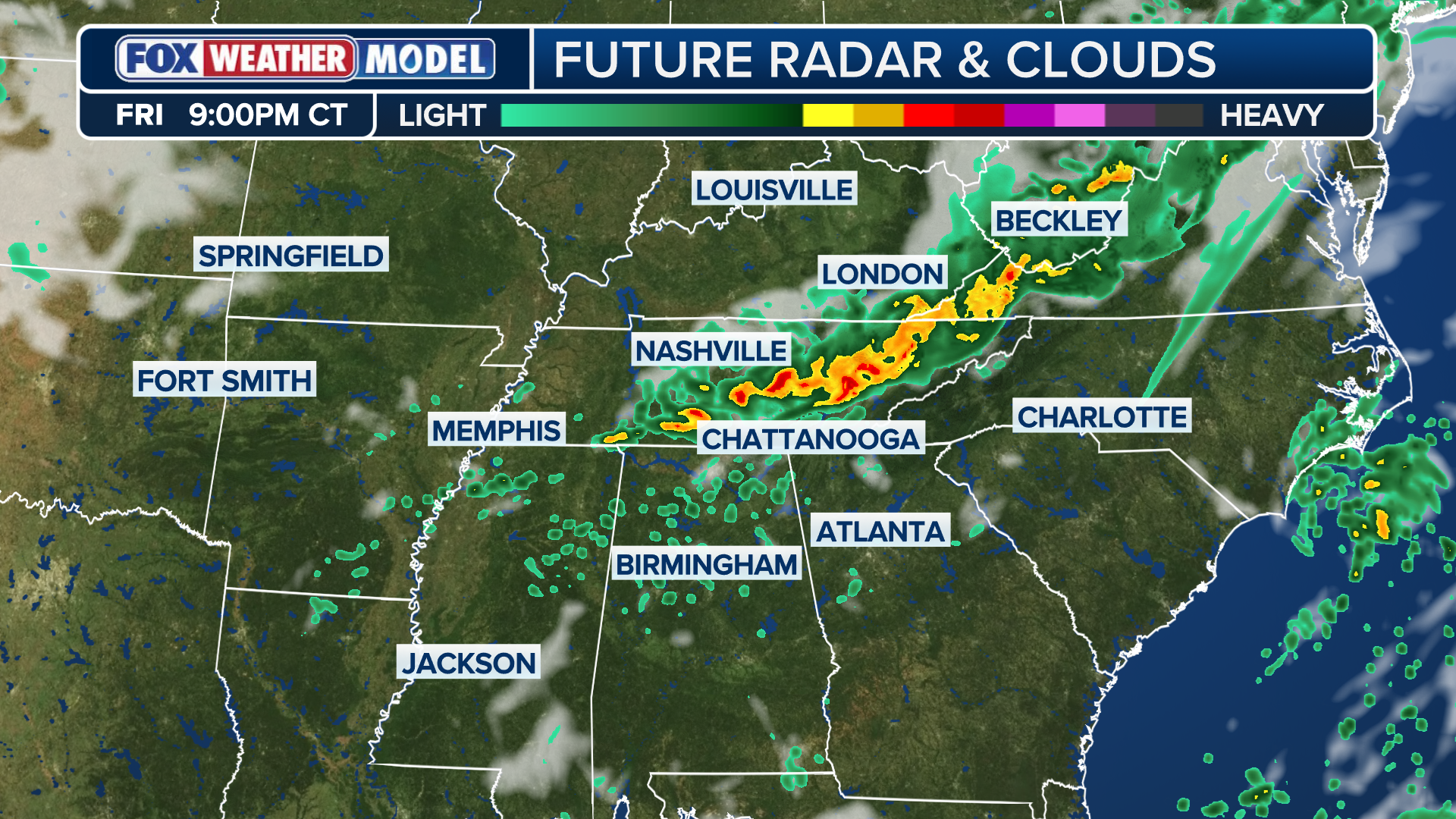
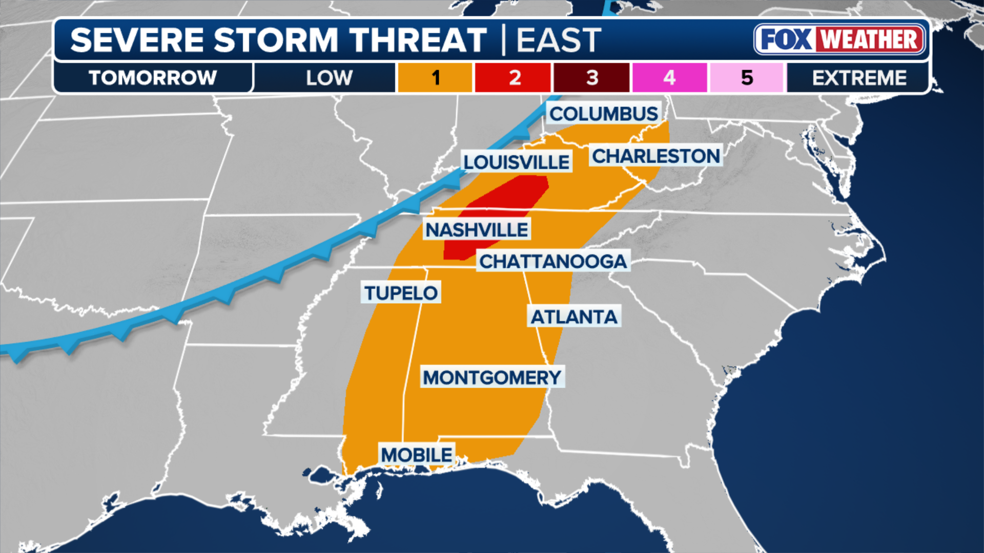
Growing instability ahead of the storm, combined with the clash of air-masses, will allow for the development of severe storms on Friday afternoon and last through the evening, with the best chance for severe weather existing across the Tennessee Valley, where a level 2/5 severe storm threat exists.
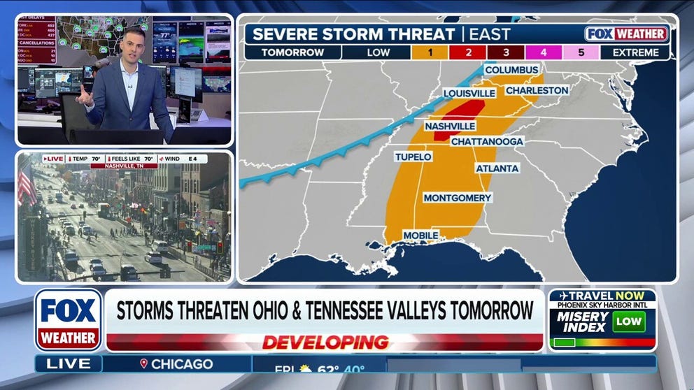
NASHVILLE, TN – As the second severe weather season gets underway, storms are expected to develop across parts of Tennessee and the Ohio Valleys on Friday.
More than 20 million Americans from Mobile, Alabama to Lexington, Kentucky are under the risk of severe storms as gulf moisture is expected to clash with a cold front ahead of the invasion of potentially freezing temperatures next week.

(FOX Weather)
A cold front trailing an area of low pressure that is expected to develop by Friday will extend south into the southern Tennessee Valley.
The cold air moving from the north and gulf moisture drawing north is expected to clash, as the ingredients for severe storms threaten weekend plans for millions of Americans.
HOW TO WATCH FOX WEATHER
According to the FOX Forecast Center, scattered severe storms are possible dependent on how much destabilization can occur ahead of the front.

(FOX Weather)
Growing instability ahead of the storm, combined with the clash of air-masses, will allow for the development of severe storms on Friday afternoon and lasting through the evening.
FIRST TASTE OF LA NINA WINTER AHEAD WITH BIG FREEZE, SNOW
A level 2/5 severe storm threat exists across the Tennessee Valley.


FILE: A rainy Broadway in Nashville, Tennessee, is seen on May 20, 2025.
(Robert Ray / FOX Weather)
While Music City is never short of percussion, there’s a chance they see a tad more noise than usual on Friday.
The main threat of the severe storm risk will be large hail where tropical moisture and the highest shear will be located, as threats of hail loom in Nashville, as well as areas in south-central Kentucky and Middle Tennessee.
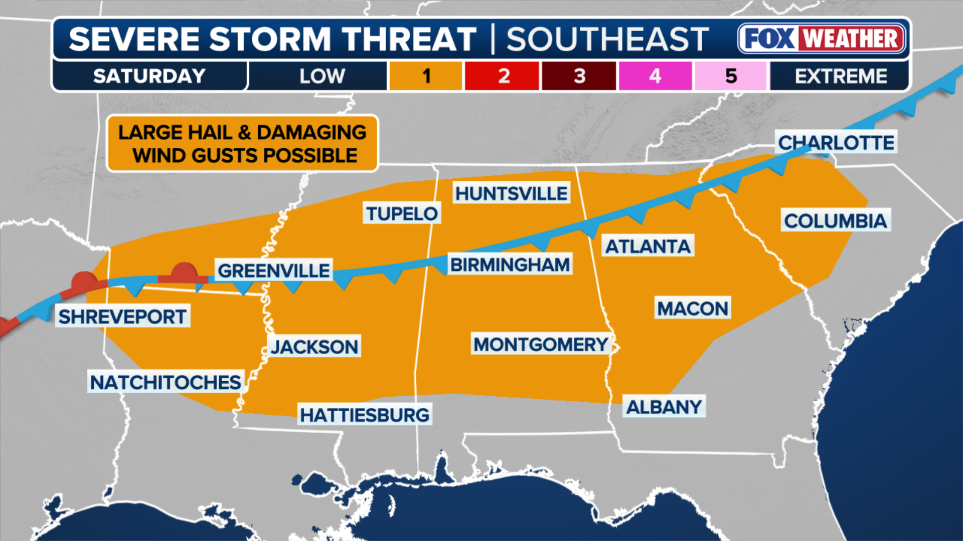
Saturday’s Severe Weather Threat Eyes The Southeast
According to the FOX Forecast Center, by Saturday morning most of the storms will have come to an end across the Mid-South, with the cold front forecast to stall and eventually dissolve.
As Friday’s storms dwindle, leftover boundaries will be the focus for any new severe storm developments over the weekend.
HOW MUCH SNOW WILL WE SEE THIS WINTER ACROSS AMERICA?
These storms will come ahead of a blast of arctic air that could break record temperatures as parts of the Southeast are expected to see a significant dip in temperatures, with projected low temperatures in the 30s on Monday for places like Atlanta and as far south as JacksonMississippi.
(FOX Weather)
Into the weekend on Saturday, a level 1/5 severe storm threat exists across most of the Southeast, extending across the region from Shreveport, Louisiana to Columbia, South Carolina.


