


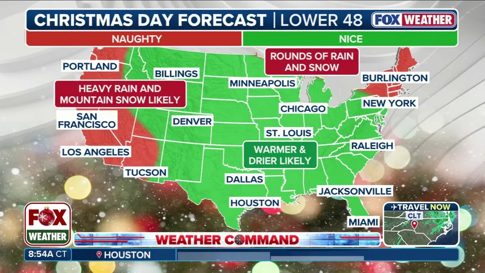
A dangerous flood threat has been issued for Southern California on Christmas Eve into Christmas Day, expect major travel delays. Meanwhile, it will be warm across much of the rest of the country across the Christmas holiday. Those hoping for a White Christmas will need to head to elevation in the Sierra, the interior Northeast, or close to the Canadian border in the Northern Tier.
NEW YORK – People in the Northeast are in the clear traveling to their holiday destinations, but prepare for some accumulating snow and ice to come shortly after.
The FOX Forecast Center predicts that most of the Northeast will experience a brief lull in activity before another round of snow moves in on Christmas night and into the day on Saturday.
CHRISTMAS WEATHER OUTLOOK: MILLIONS TO SEE ‘NICE’ FORECAST WITH A TOUCH OF ‘NAUGHTY’ ACROSS NATION
While there’s still some uncertainty about the exact position of the worst impacts, timing is coming into better focus with rain, snow and ice arriving Friday and lasting into mid-Saturday.

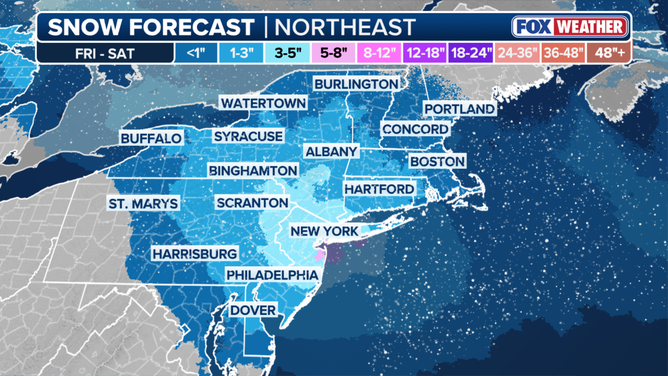
The FOX Forecast Center predicts most of the Northeast will see 3 to 5 inches of snow.
(FOX Weather / FOX Weather)
Accumulating snow is likely from the Catskills and Poconos into the tri-state region. The FOX Forecast Center said central New Jersey through New York City and into southern Connecticut will see a widespread 3 to 5 inches of snow.
Locally higher amounts of 5 to 8 inches are possible. The exact track of the storm and how much cold air sticks around will determine how much snow we’ll see.
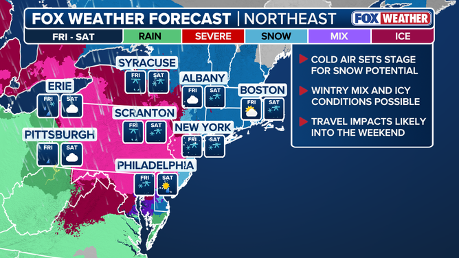
Different cities across the country will see different impacts from the storm.
(FOX Weather / FOX Weather)
Winter Weather Advisories or Winter Storm Warnings will most likely be issued in the coming days.
AIRPORT GROUND STOPS VS. GROUND DELAYS: WHAT ARE THEY AND HOW DO THEY HAPPEN?
A strong high pressure system over Quebec will also pose an ice threat, with one-tenth to a quarter inch of ice accretion possible across central Pennsylvania. Isolated ice amounts over a quarter of an inch could cause scattered power outages.
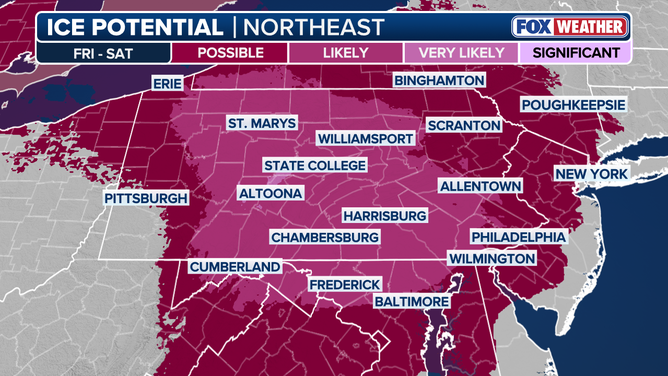
Ice accretion is possible in parts of the Northeast immediately after Christmas, according to the FOX Forecast Center.
(FOX Weather / FOX Weather)
Locations at risk for the highest ice accretion include State College in Pennsylvania through Fredrick, Maryland.
This could cause treacherous road conditions Friday afternoon and evening through early Saturday. But given the speed of the system, most areas will dry out by Saturday afternoon.
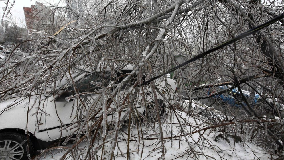
Ice storms can have a much more crippling effect than a snowstorm.
Our FOX Forecast Center said you should also be on the lookout for another storm system that will likely impact the Northeast at the end of the weekend and into the start of New Year’s Eve week. This fast-moving system will likely bring a mixture of rain and snow.
HOW TO WATCH FOX WEATHER
FOX Weather has got you covered with the latest and up-to-date information as we approach the holidays.


