
Just days after a historic blizzard buried millions across the Northeast, more snow is falling across parts of the interior Northeast and New England in what has been the most active winter in recent years for the region. Fortunately, for the winter-weary, this is a fast-moving system that will reach the coast through the morning commute on Wednesday before quickly exiting by the afternoon. Meanwhile, forecasters are monitoring another chance for rain and snow on Thursday and Friday morning.
Just days after a historic blizzard buried millions across the Northeast, more snow is falling across parts of the interior Northeast and New England in what has been the most active winter in recent years for the region. Fortunately, for the winter-weary, a fast-moving system that reached the coast through the morning on Wednesday before quickly exiting by the afternoon.
Flakes fell Wednesday morning from West Chester, Pennsylvania, through New York City, Boston and into Maine.
Meanwhile, forecasters are monitoring another chance for rain and snow on Thursday and Friday morning.
HISTORIC BLIZZARD OF 2026 SMASHES SNOW RECORDS AS MILLIONS BEGIN TO DIG OUT FROM VICIOUS BOMB CYCLONE
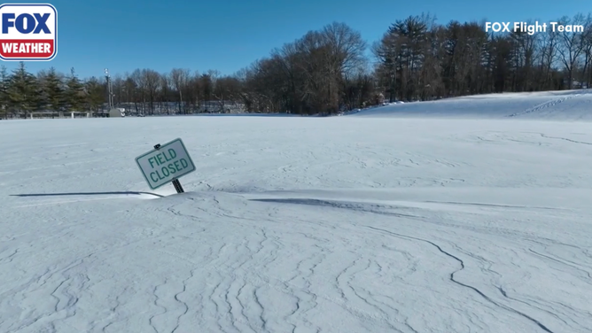
A sign saying the field was closed after the blizzard in Orangetown, NY.
(FOX Flight Team)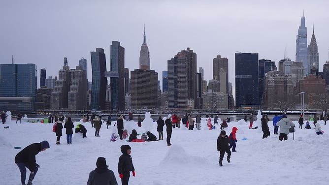
NEW YORK, UNITED STATES – FEBRUARY 23: Families and citizens enjoy snow after a powerful, multi-day blizzard dumped about 19 inches of snow in Long Island City, New York, United States on February 23, 2026.
((Photo by Selcuk Acar/Anadolu via Getty Images))
Pedestrians walk through snow in Central Park during a winter storm in New York, US, on Monday, Feb. 23, 2026.
(Photographer: Chris Ratcliffe/Bloomberg via Getty Images)
Snow plows clear the roads in Farmingdale, New York.
(@nysdotli / X)
Snow covers cars and sidewalks during the blizzard in Staten Island.
(Alison)
Photo of snowdrift outside a garage in Yaphank, NY
(Jeanine)
A little pup is blocked from the yard by nearly a foot of snow in North Patchogue, NY, Feb. 23, 2026.
(Nick Minnella)
People walk along snow covered streets as snow falls during a blizzard on February 23, 2026 in the Flatbush neighborhood of the Brooklyn borough in New York City.
(Photo by Michael M. Santiago/Getty Images)
MTA buses during a winter storm in the Brooklyn borough of New York, US, on Monday, Feb. 23, 2026.
(Photographer: Michael Nagle/Bloomberg via Getty Images)
On Sunday, more than 40 million people were slammed by extreme snowfall. New York City recorded about 20 inches, while Providence, Rhode Island, experienced almost 38 inches and Boston saw close to 17 inches, all told.
The clipper system from Southern Canada moved through the Great Lakes, into western Pennsylvania and dropped snow into the Northeast.
Snow fell across parts of Michigan’s Upper Peninsula, as well as parts of the Appalachians in West Virginia and Western Virginia.
MAJOR CITIES IN THE NORTHEAST SLAMMED WITH 2 FEET OF SNOW OR MORE FROM HISTORIC BLIZZARD OF 2026

(FOX Weather)
Accumulations were not significant but added a small layer of flurries that hampered the morning commute in many locations along the coast that continue to dig out from Monday’s historic blizzard.
Meanwhile, parts of Upstate New York that were not impacted by the weekend coastal system could see some lake-effect snow early Wednesday afternoon off the shores of Lakes Erie and Ontario.
(FOX Weather)
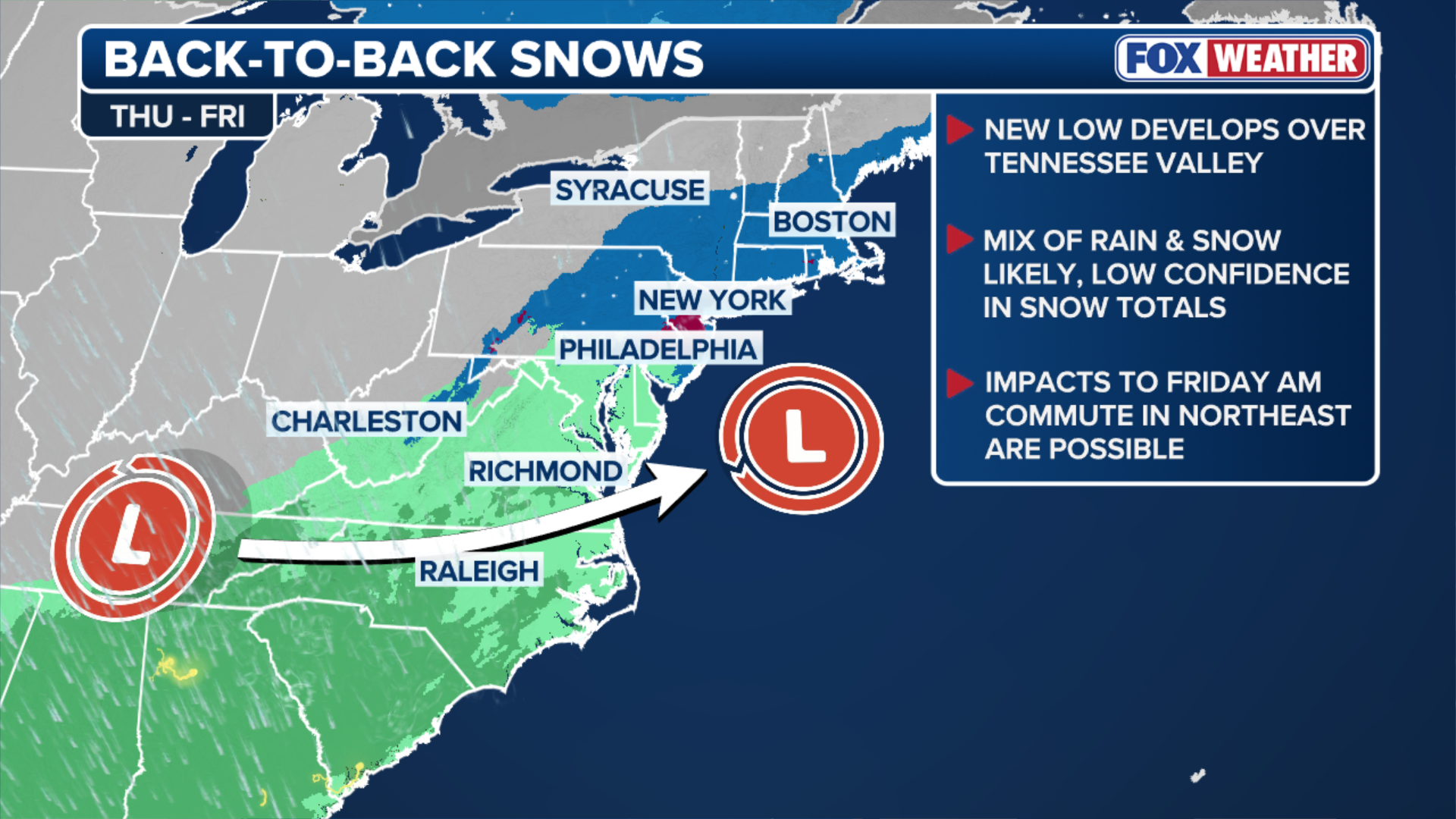
Thursday’s storm is looking less impactful for the Northeast. An area of low pressure is expected to move east from the Central Plains by Thursday afternoon.
According to the FOX Forecast Center, forecast models currently are suggesting a more southerly track with this system.
This would keep the rain and lighter snow across parts of the Mid-Atlantic and Southeast.
PROVIDENCE SHATTERS 48-YEAR RECORD FOR ALL-TIME BIGGEST SNOWSTORM WITH OVER 37 INCHES OF HEAVY SNOW

Strong winds and heavy snow break tree branches in Forked River, NJ, Feb. 23, 2026
(Mark Stephens)
“The trend is kind of keeping this more of a rain story than a snow story and also impacting more of the Mid-Atlantic than the Northeast,” FOX Weather Meteorologist Britta Merwin said Wednesday morning.
Even before the next round of snow arrives, many cities are already well above their average seasonal snowfall.
Boston, for example, now sits nearly 10 inches above average following the recent historic blizzard.
Stay with FOX Weather as these systems continue to develop.