

Straight-line damaging winds, hail, and flooding are all possible on the East Coast.
WASHINGTON – Millions of people along the Interstate 95 corridor on the East Coast are bracing for the threat of severe weather, with cities like Washington and Baltimore facing the risk of some tornadoes.
NOAA’s Storm Prediction Center has placed a large majority of the eastern U.S. from Georgia in the Southeast to the nation’s capital in the mid-Atlantic in a Level 2 risk on its 5-point severe thunderstorm risk scale.
HOW TO WATCH FOX WEATHER
This includes cities like Savannah in Georgia, Columbia in South Carolina, Wilmington and Raleigh in North Carolina, Richmond and Virginia Beach in Virginia and Washington, D.C.
A Tornado Watch was issued for more than 10 million people in the mid-Atlantic, including cities like Washington and Fredericksburg and Richmond in Virginia.
The main threats from thunderstorms that develop will be damaging wind gusts and hail, but there’s also the risk of some tornadoes in the mid-Atlantic.
DOWNLOAD THE FREE FOX WEATHER APP
Tornadoes will be possible in portions of North Carolina, Virginia, Maryland, Delaware, and Washington, D.C.
However, the higher tornado threat is located along the Interstate 64 corridor from Norfolk to Richmond in Virginia, as well as along the I-95 corridor from south of Richmond northward to Washington.
WATCH VS. WARNING: HERE ARE THE DIFFERENCES BETWEEN THESE WEATHER TERMS THAT COULD SAVE YOUR LIFE
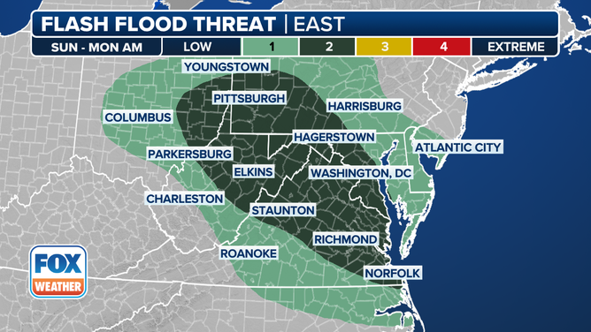
This graphic shows the flash flood threat on Sunday, June 8, 2025.
(FOX Weather)
Heavy rain could also lead to some flooding across portions of the Northeast and mid-Atlantic.
NOAA’s Weather Prediction Center placed portions of seven states and the Washington, D.C., area at a Level 2 out of 4 risk for flash flooding.