
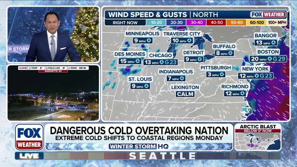
The coldest air of the season is blanketing the Midwest, Northeast, and Southeast, with dangerous low temperatures. More than 50 million people can expect to see single-digit wind chill temperatures Monday.
NEW YORK — The coldest air of the early winter season is blasting the eastern U.S. Monday with single-digit temperatures with the wind chill, as the Polar Vortex unravels and with it, brings dangerous arctic air to millions from New England to the Gulf Coast.
-
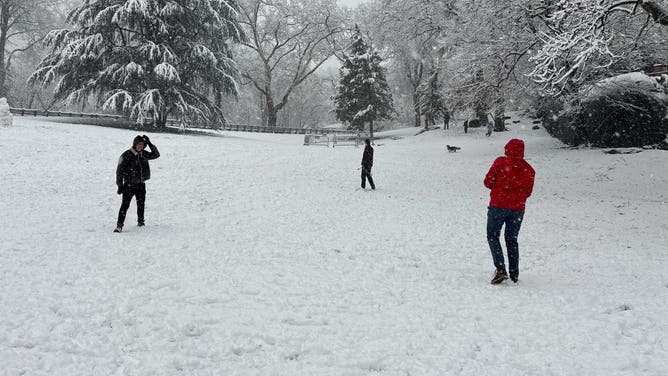
Snow blanketed New York City Sunday morning.
(FOX Weather) -
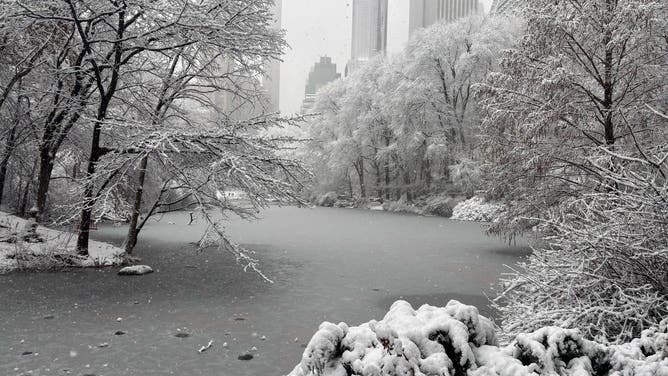
Snow blanketed New York City Sunday morning.
(FOX Weather) -
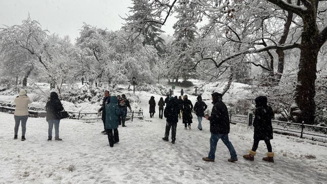
Snow blanketed New York City Sunday morning.
(FOX Weather) -
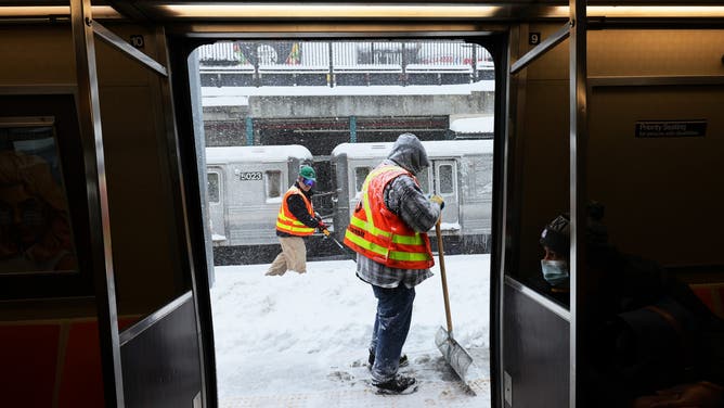
NEW YORK, NEW YORK – FEBRUARY 01: Workers clear snow off a subway station platform in the Midwood neighborhood of Brooklyn on February 01, 2021 in New York City.
( (Photo by Michael M. Santiago/Getty Images)) -

Snow falls across Chicago.
(Robert Ray/FOX Weather) -

FILE – A man walks through the snow with a scarf over his face in Washington, DC, on January 8, 2014, as dry and unseasonably cold weather hits the area. An Arctic blast sweeping Canada and parts of the United States this week closed schools, grounded jets, killed at least four people, and even shook the ground. AFP PHOTO/JIM WATSON (Photo credit should read JIM WATSON/AFP via Getty Images)
( ) -

FILE – People walk in cold temperatures in New York City on January 17, 2024.
(ANGELA WEISS/AFP via Getty Images) -

FILE – People walk through the freezing cold in the Brooklyn borough of New York on January 31, 2019.
(ANGELA WEISS/AFP)
For those in the Northeast and Midwest, this comes on the heels of a fast-moving winter storm this weekend, with subzero temperatures set to freeze leftover snow during the morning and afternoon commutes.
WHAT IS A WINTER STORM WARNING?
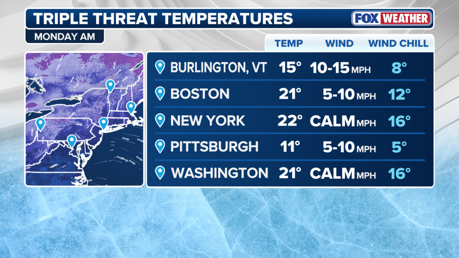
Meanwhile, most of the Southeastern U.S. is under a Cold Weather Alert Monday morning with temperatures in the teens, factoring in the wind chill, just six days ahead of the start of astronomical winter on Sunday.
(FOX Weather)
More than 70 million Americans are under Cold Weather Alerts Monday, in what the FOX Forecast Center said could end up being the coldest day of the year when considering wind chills.
Wind chill temperatures were in the single-digits and teens across the Midwest and Northeast on Monday morning.
TRAVEL NIGHTMARE: WINTER SNOWSTORM CAUSES DELAYS AND POWER OUTAGES ACROSS THE NORTHEAST
Indianapolis issued its first Extreme Cold Warning for Monday, with expected wind chill temperatures as low as -25 degrees. Detroit has activated warming centers through Tuesday.
In the Northeast and Mid-Atlantic, cities like New York and Baltimore have activated Code Blue warming centers, aimed at providing relief from the extreme temperatures for the unhoused population.
(FOX Weather)
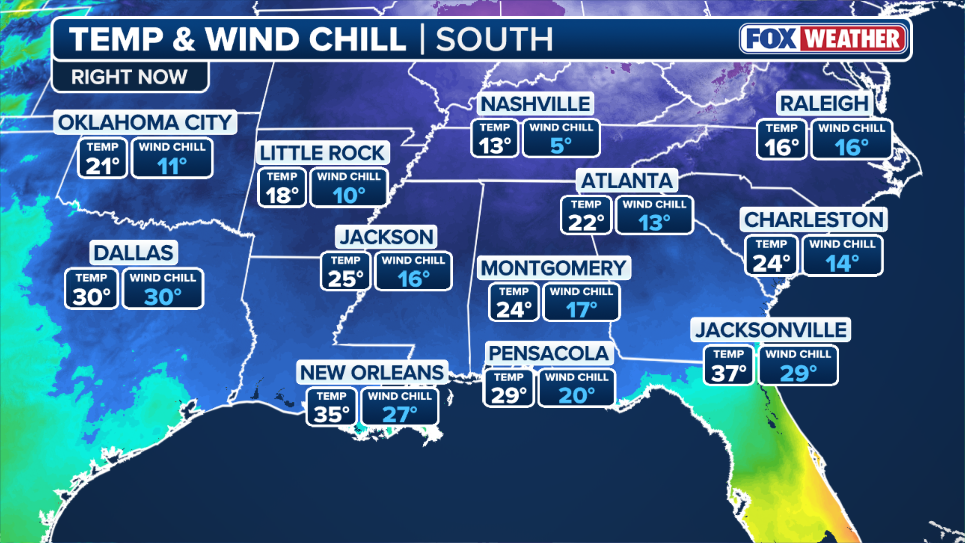
Wind chill temperatures reached single digits in Nashville Monday morning and were in the teens in Jackson, Mississippi.
Atlanta and Birmingham, Alabama have also activated warming centers through the first half of the workweek.
The bitter arctic air will linger into Tuesday, particularly in the Northern Tier, before a quick warmup by midweek.