
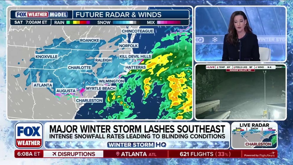
Snow is falling in the Carolinas as a major nor’easter rattles the East Coast. Dangerous cold accompanied by tropical storm-force wind gusts, blizzard conditions and coastal flooding are all expected as the storm continues to develop.
Snow is falling in the Carolinas and Virginia as a major winter storm moves across the Southeast, bringing dangerous cold, blustery winds and even the possibility of blizzard conditions throughout the weekend.
A coastal low is developing off the coast of the Carolinas, and is expected to rapidly intensify as the day progresses, pulling moisture north, while helping to lock cold air in place.
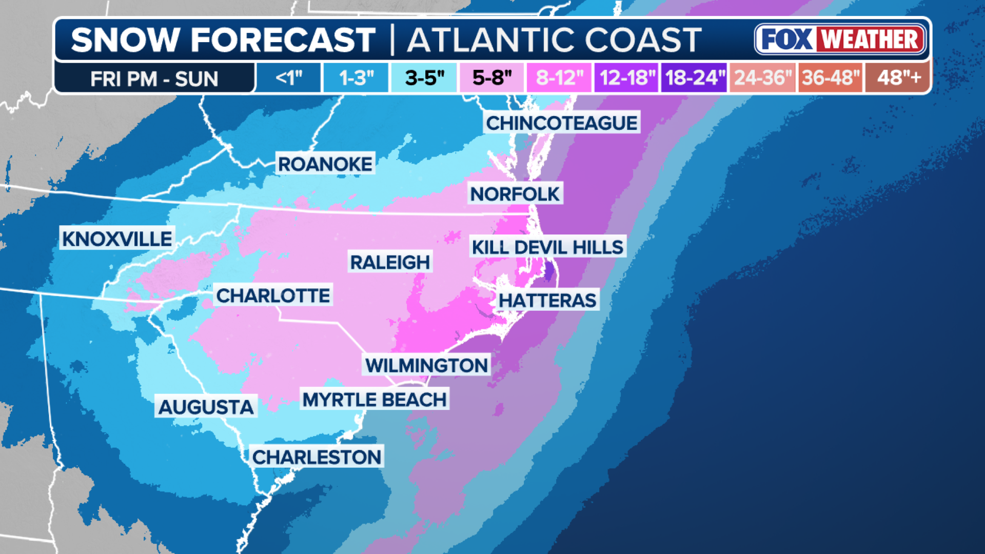
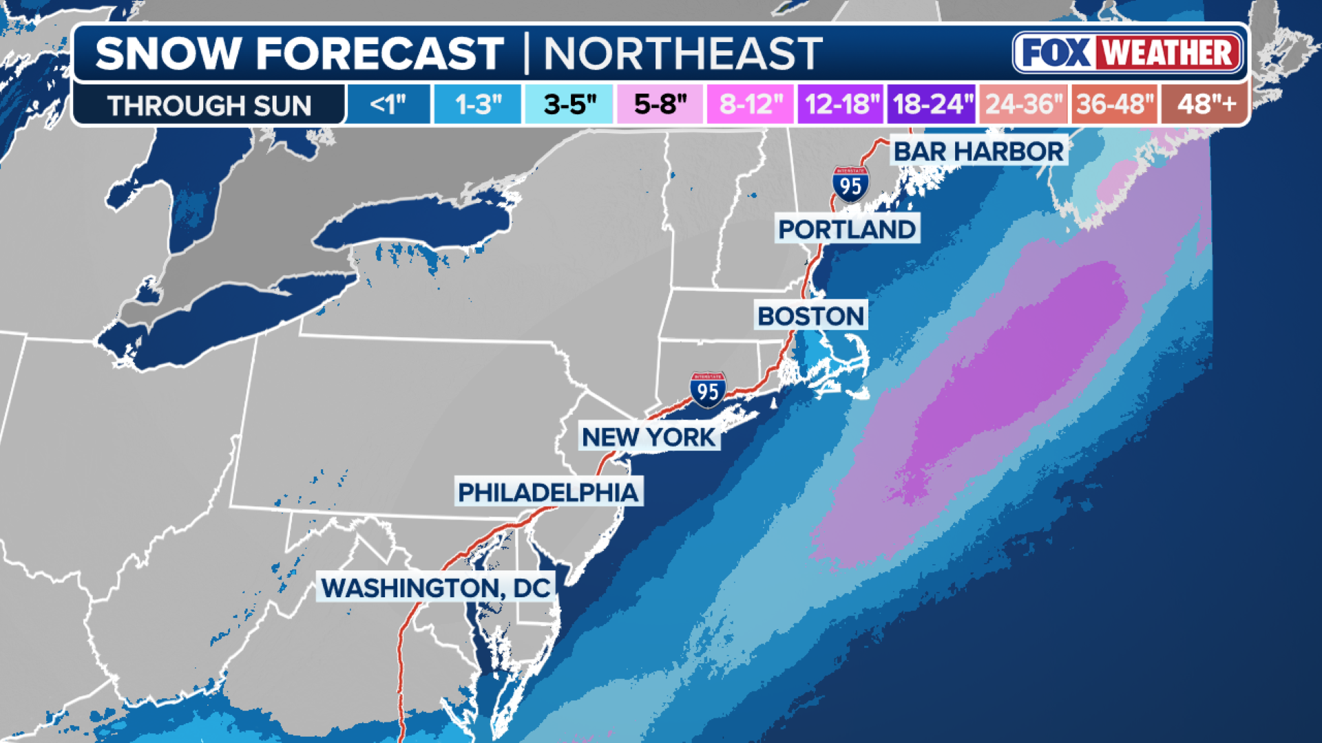
By Saturday night, this system will continue to dump intense snow over the Carolinas and Virginia, where snow totals could reach upwards of 5-8 inches by the weekend’s end.
TIMELINE: SEE WHEN THE NOR’EASTER WILL ‘BOMB’ OUT NEAR EAST COAST, REACHING YOUR AREA WITH HEAVY SNOW, WINDS
(FOX Weather)
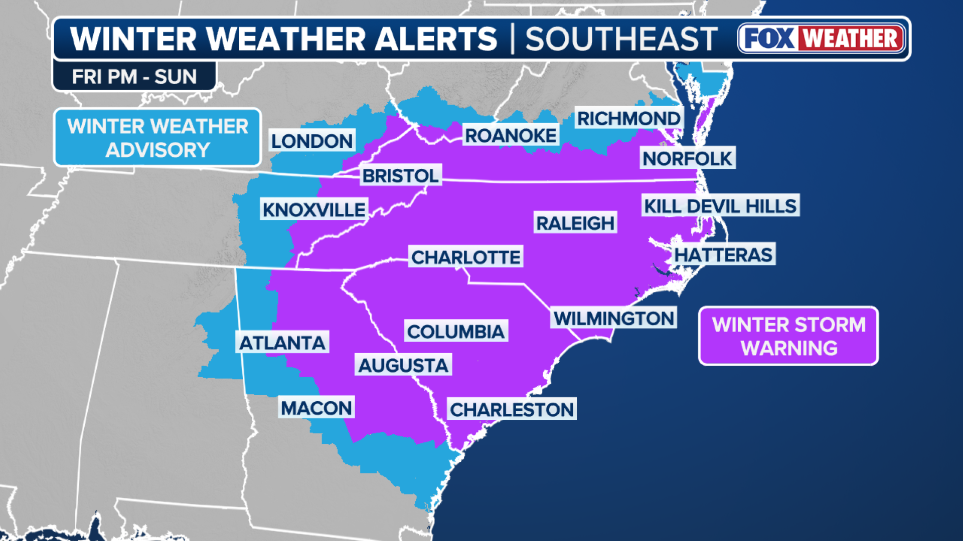
Winter Weather Alerts stretch from the southern tip of Georgia all the way north into Maryland through Sunday.
States of Emergency are in place in Georgia and North and South Carolina as preparations continue for this nor’easter.
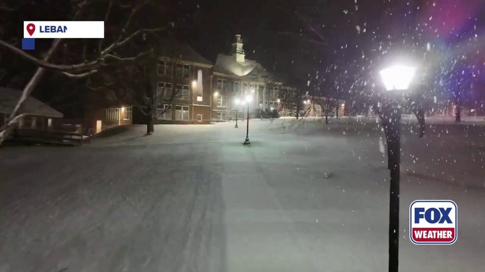
A major winter storm is bringing snow to the Mid-Atlantic and Southeast. Video from Lebanon, Virginia on Friday night shows the picturesque snow falling throughout the town.
Officials urged residents to stay home and off the roads this weekend.
“Fewer vehicles on the roads give GDOT crews the space they need to treat roadways safely and efficiently, helping keep everyone safer this weekend,” said Josh Lamb, director of the Georgia Emergency Management and Homeland Security Agency.
AMERICAN RED CROSS DECLARES SEVERE BLOOD SHORTAGE INTENSIFIED BY EXTREME WINTER WEATHER RAVAGING US
(FOX Weather)
The FOX Forecast Center is monitoring this storm for something called “bombogenesis,” or when a storm’s central pressure rapidly drops in a short period of time.
This leads to rapid intensification, which could result in intense tropical storm-force wind gusts, especially along the coastline.
(FOX Weather)
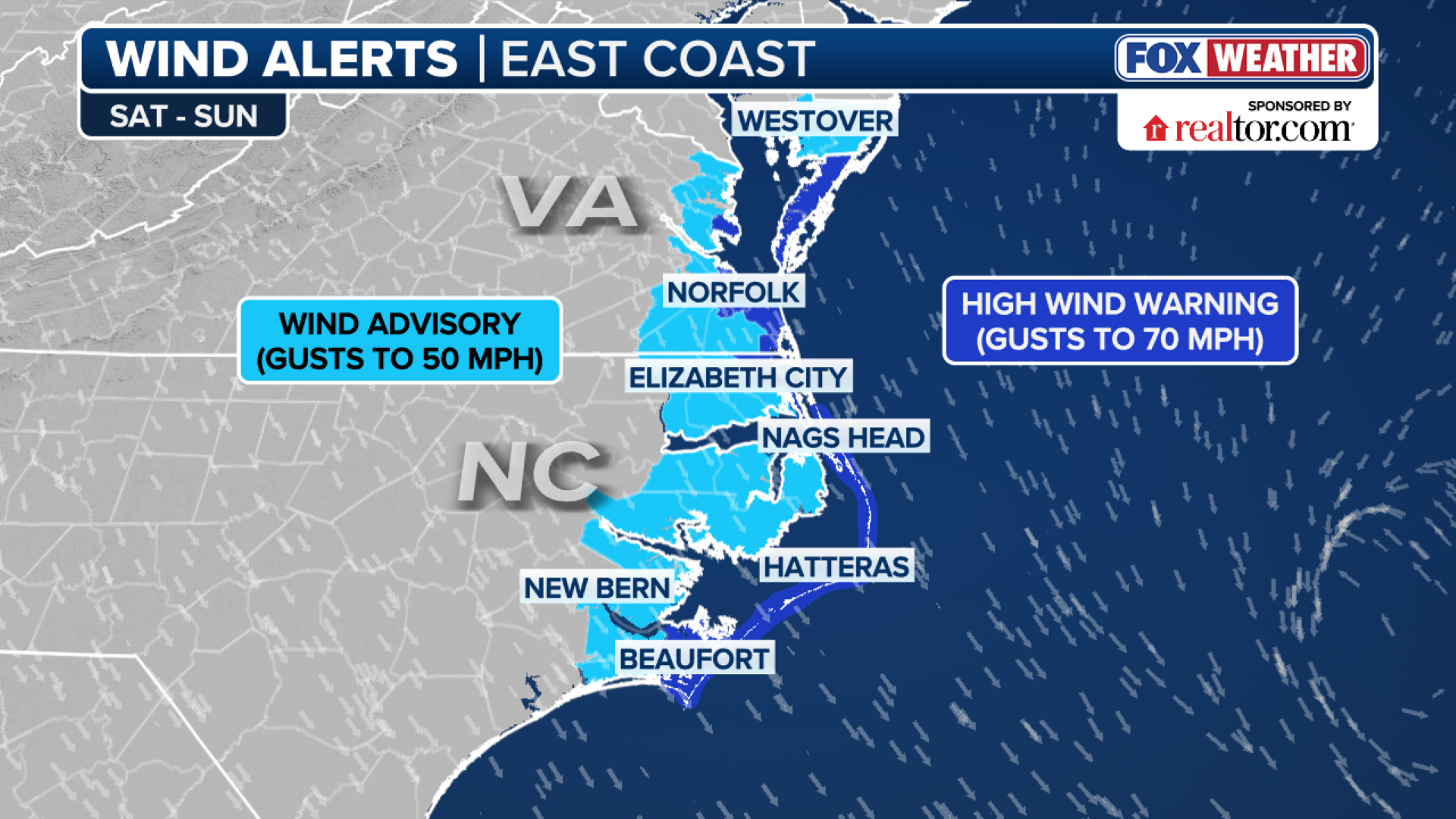
Wind alerts stretch from North Carolina into Virginia, where gusts between 50-70 mph are possible.
“When you look at this in relation to a tropical system, this could, and let me emphasize could, be compared to a winter tropical storm,” said FOX Weather Meteorologist Michael Estime.
NOR’EASTER BOMB CYCLONE STORM TRACKER: LIVE RADAR, SNOW FORECAST, WINTER WEATHER ALERTS, TRAVEL DISRUPTIONS
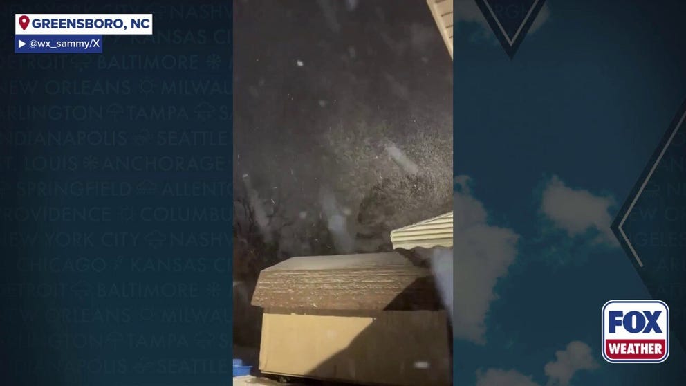
Heavy, blowing snow is falling in the Carolinas as a major nor’easter storm blasts the Southeast with strong winds, intense snowfall and even the possibility of blizzard conditions.
The wind, combined with rapid snowfall and low visibility, could create blizzard conditions for the coast, particularly along the Outer Banks.
Coastal flooding and erosion are also a concern with this system.
Winter storm impacts in the Northeast
As the area of low pressure develops and moves northward, impacts will begin to stretch into the Northeast and New England on Sunday.
The FOX Forecast Center said the exact track of the storm remains slightly uncertain, but many forecast models show the storm keeping snow off the coast until reaching Massachusetts and southern New England.
HOW TO WATCH FOX WEATHER
(FOX Weather)
In the more aggressive scenarios, moderate to heavy snow is possible, particularly from eastern Massachusetts into Maine. Other outcomes, however, keep the bulk of the snow offshore with little accumulation inland.
The highest confidence for meaningful impacts is across southeastern Massachusetts, especially the Cape and Islands. Even with a somewhat offshore track, this area could still see snow, strong winds, and hazardous marine conditions.
This is a developing story. Stick with FOX Weather for the latest forecast and developments: