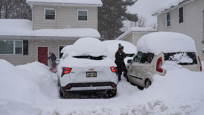
Lake-effect snow is once again firing relentlessly, with hazardous lake-effect snowbands expected to persist through Wednesday as Arctic air continues to pour over the warmer Great Lakes.
Areas around Buffalo and Watertown in upstate New York are well-known lake-effect hotspots and will be hit the hardest, where prolonged snowbands could be measured in feet.
RELENTLESS SNOW BLANKETS MIDWEST, WESTERN NEW YORK AS LAKE-EFFECT MACHINE HAMMERS WEST MICHIGAN, BUFFALO
Whiteout conditions are possible near the lakes, and travel impacts are likely at times, as visibility drops quickly within the most intense bands and conditions may change rapidly.

Great Lakes snow to come through Wednesday
(FOX Weather / FOX Weather)
Lake Erie and Lake Ontario
Snow is expected to pick up early Monday morning, especially downwind of Lake Erie and Ontario, as a strong Arctic cold front will move through the Great Lakes region, bringing a sharp drop in temperatures, gusty winds and heavy lake-effect snow.
The FOX Forecast Center said snowfall rates could reach 1–2 inches per hour, with isolated bursts approaching 3 inches per hour near the lakes, and even a few rumbles of thunder possible in the heaviest bands.
The snow will create hazardous travel conditions, especially around Buffalo and Watertown, with blowing and drifting snow and periods of near whiteout conditions. Gusty winds of 30–50 mph will also add to the hazards.
Lake-effect snow will continue through Tuesday night, with the bands shifting slowly south and north due to changing wind directions.

Blowing sand and snow in Benton Harbor, Michigan, on Jan. 14, 2026 during a lake-effect snow storm.
(FOX Weather Correspondent Robert Ray / FOX Weather)
WEEK-LONG SERIES OF INTENSE, LAKE-EFFECT SNOWSTORMS FOR GREAT LAKES WRAPPING UP AFTER DUMPING FEET OF SNOW
Snow from Lake Erie will move into southern Erie County and the Southern Tier, while Lake Ontario’s snowband will impact Tug Hill and Watertown before drifting back north.
The FOX Forecast Center said snow totals will vary by location depending on how long the snow bands linger, so some areas may see heavier totals than others.
LIVE UPDATES: ANALYSIS OF ROUGHLY 100 CAR MICHIGAN PILEUP FROM BLINDING VISIBILITY
The highest totals will be off Lake Ontario, where over 2 feet of snow is likely, and near Buffalo, where closer to a foot is expected.
Overall, heavy snow, gusty winds and very cold temperatures will make travel difficult and conditions hazardous through midweek.

Great Lakes snow totals for the season to date
(FOX Weather / FOX Weather)
The Great Lakes region has already seen intense lake-effect snow this season so far, with locations like Syracuse, New York, reporting exceptionally high totals and a record-setting daily snowfall amount.
Lake Michigan and Lake Superior
Early on Monday, an Arctic cold front will move through the Upper Midwest and western Great Lakes region.

Lake Michigan snow to come through Wednesday
(FOX Weather / FOX Weather)
This will shift winds to the west and northwest, pushing snow farther inland, with a focus over the mitten of Michigan.
Intense winds, gusting 30–40 mph, will cause blowing and drifting snow, as well as frequent sudden drops in visibility. The same will be farther north, across the Upper Peninsula of Michigan, but winds will be more out of the north over Lake Superior.
By Monday night, the FOX Forecast Center said snow amounts should easily exceed a foot across much of the lakeshore counties, with some spots possibly reaching higher amounts due to drifting.
HOW TO WATCH FOX WEATHER
Farther inland, across central and south-central Michigan, amounts will likely be around 1–3 inches, and the Center said travel could still be quite hazardous due to blowing snow, slick roads and rapidly changing visibility.
Just last week, FOX Weather Correspondent Robert Ray was in Benton Harbor, Michigan, where lake-effect snow yet again pounded the region. The winds were so strong, it blew the snow sideways, creating low visibility.
Lake-effect snow will continue into Monday night but should gradually weaken.


