

Flood Watches have been issued across Kansas City and the Plains as rounds of thunderstorms could lead to flooding.
KANSAS CITY, Mo. – Forecasters are monitoring part of a three-state region across the Plains for the threat of flooding over the next 48 hours.
Counties in Kansas, Nebraska and Missouri are all under Flood Watches as a slow-moving frontal boundary sets the stage for rounds of showers and thunderstorms into early Saturday.
Forecast models indicate that rainfall totals of 2-4 inches are possible across the Kansas City metro, with isolated communities potentially seeing more than 6 inches.

(FOX Weather)
“I will say Pleasant Hill, that’s the Kansas City office, issuing those Flood Watches last night because they knew that this event was going to be coming,” said FOX Weather meteorologist Stephen Morgan. There’s been a signal here that we could have a heavy rain event in KC.”
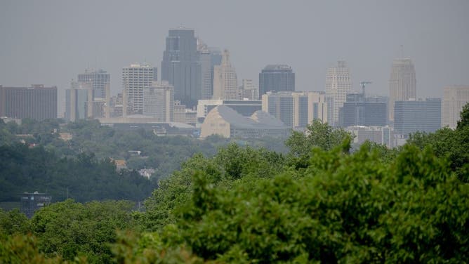
The downtown skyline of Kansas City is coated with haze on June 5, 2023.
(Nick Wagner/The Kansas City Star/Tribune News Service via Getty Images / Getty Images)
Due to the threat, NOAA’s Weather Prediction Center has also placed parts of northeast Kansas and northwest Missouri under a moderate threat of flooding or a Level 3 out of 4 on its risk scale.
This means that there’s at least a 40% chance of rainfall exceeding flash flood levels, which doesn’t guarantee flooding but does highlight the likelihood of rain overwhelming drainage systems, leading to problems.
(FOX Weather)
ONE OF THE MOST FLOOD-PRONE CITIES IN AMERICA IS ABOUT TO SEE A WHOLE LOT MORE WARNINGS
“Conditions are favorable for repeated thunderstorms with heavy rainfall which could result in flash and river flooding,” National Weather Service meteorologists stated.
In the stronger convection, rainfall rates may exceed 2 inches per hour, especially north of the Interstate 70 corridor.
Forecasters reminded residents that just 6 inches of moving water can knock an adult off their feet, while a foot of floodwater can cause a vehicle to stall and float away.
Earlier in the week, authorities said a 62-year-old was killed after venturing too close to a flooded creek southwest of Kansas City, in Overland Park, Kansas.

(FOX Weather)
KNOW YOUR FLOOD TERMINOLOGY: WHAT FLOOD WATCHES, WARNINGS AND EMERGENCIES REALLY MEAN
Most of the activity is expected to remain below severe weather criteria, but there is a chance that a few cells could produce damaging wind gusts or trigger a brief Tornado Warning.
Forecasters will be monitoring the Topeka area closely, where rainfall rates over the past two weeks are running in the neighborhood 300-600% above normal.
Additional rainfall on top of already saturated grounds can quickly lead to flooding with little warning.
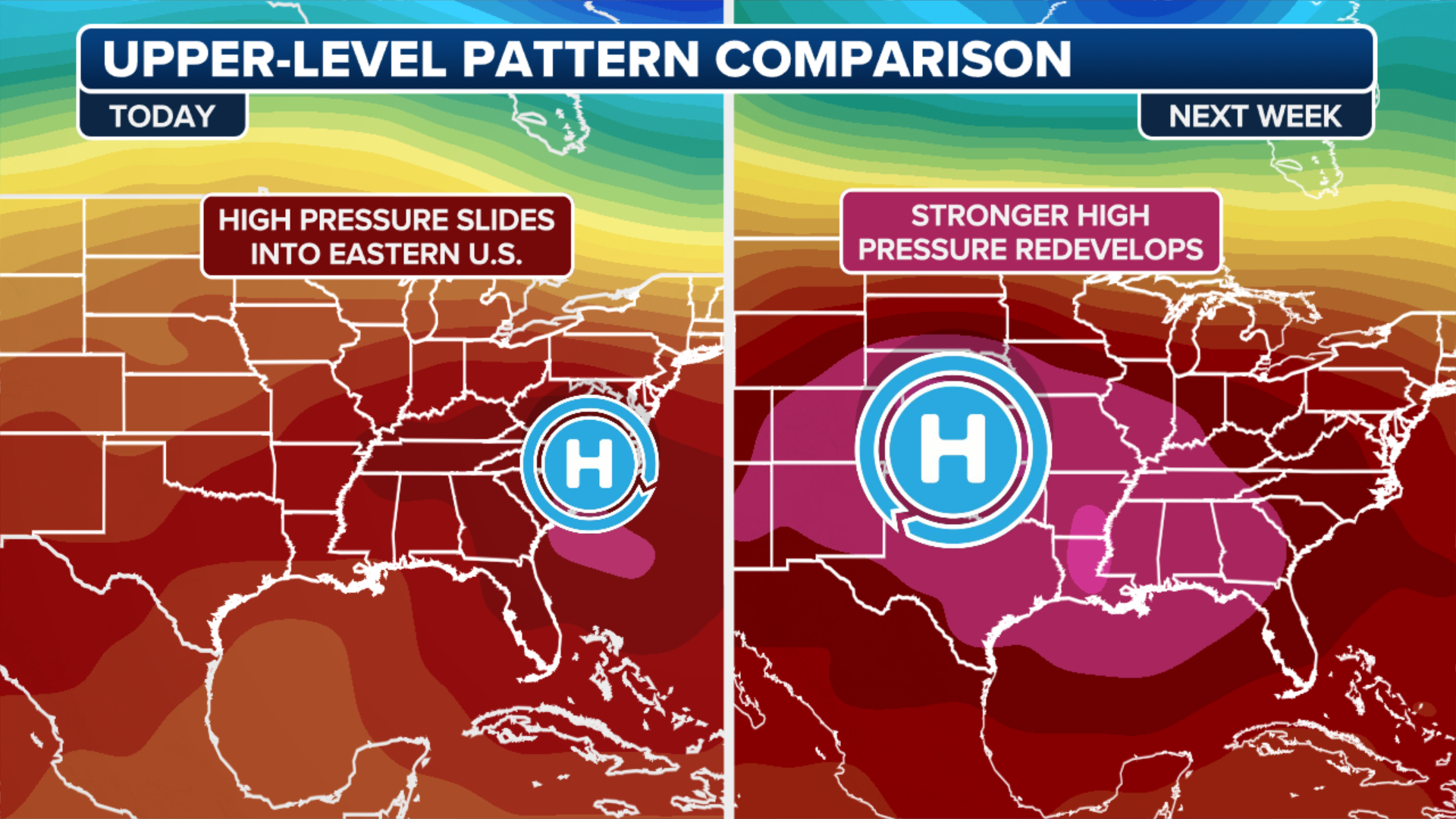
After the rainfall, a ridge of high pressure is expected to build into the region, cutting rainfall chances and sending the mercury near 100 degrees starting over the weekend and lasting well into next week.
(FOX Weather)