
Fresh off a tropical wave from Africa, Invest 97L has a high chance of development over the next week as it moves into the Atlantic. FOX Weather meteorologists explain the unknowns with this system.
Updated at 10 a.m. on Aug. 10, 2025.
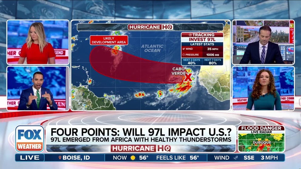
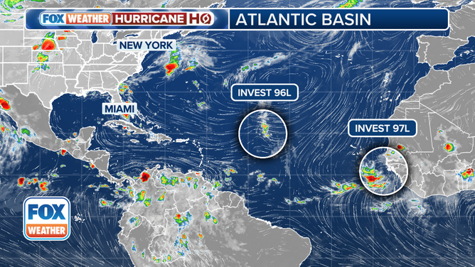
The large disturbance over the eastern tropical Atlantic – officially tagged Invest 97L – is heading west in the general direction of the Caribbean. It has found a gap in the Saharan dust, so this one has the best chance of organizing into a tropical storm or hurricane of any system we’ve tracked this season.
The National Hurricane Center now puts the odds that the disturbance will organize into at least a tropical depression this week in the high range. The system will have to fight off the Saharan dust for the next few days, at least, which should slow the intensification process.
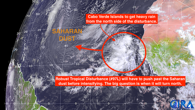
Current saharan dust
(NOAA / FOX Weather)
However, the strong consensus of the various computer forecast models is that the system will strengthen when it passes near or just north of the northeastern Caribbean islands late in the week or early in the weekend. Then the big question marks begin.
The blocking area of high pressure that will propel the system west for the next several days is forecast to slowly shift out of the way as a jet stream dip opens a path to the north next week. Whether that path is well offshore of the East Coast – potentially threatening Bermuda – or is configured such that likely-Hurricane Erin threatens the U.S. coastline is an open question.
All that’s going to happen more than a week from now, so the details are unknowable. Slight differences in the steering currents can make a tremendous difference in the end result.
Atlantic Tropical Overview
(FOX Weather)
And the cardinal rule applies: All forecasts for systems that are disorganized or just developing are subject to large errors and will likely change. This system is both disorganized and just developing.
If not for that rule, we could be slightly encouraged because a number of the latest long-range computer forecasts predict that the storm will turn north well before reaching the U.S. East Coast. But some still come dangerously close. So we don’t want to jump to conclusions one way or the other this far in advance.
As the disturbance gets organized and tracks west, we’ll watch to see how closely it hews to the 20-degree latitude line. The farther south of that line it tracks, the closer to the East Coast it seems likely to swing.
Invest 96L heads north
The other disturbance that the National Hurricane Center has been tracking – Invest 96L – is still struggling with dust and dry air. Forecasters give it a low chance of developing as it tracks into the North Atlantic. In any case, it is not a threat to land.