
Tropical Storm Erin is set to become a hurricane today as it moves into the Caribbean north of the Leeward islands. FOX Weather Hurricane Specialist Bryan Norcross analyzes Erin’s future as a possible major hurricane and the impacts that could be felt on the East Coast of the U.S. and throughout the Caribbean.
Updated 9:45 a.m. ET on Aug. 15, 2025
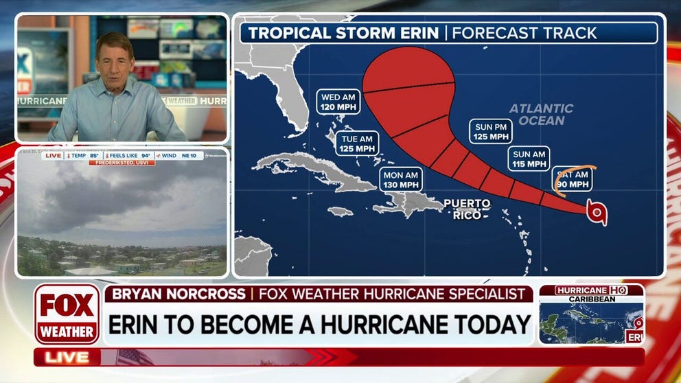
Tropical Storm Erin is likely to become Hurricane Erin shortly. It’s now tracking over ocean water that’s in the low 80s, and the dry and dusty air that has had a stranglehold on the circulation is dissipating. Steady intensification is forecast into early next week.
Erin’s track has held steady. It’s slowly lifting north now so it will pass through the waters just north of Puerto Rico and the northeastern Caribbean islands. Next week, every expectation is that the center of the hurricane will pass between the Carolinas and Bermuda and then arc out to sea. That’s not 100%, but it’s close.
FOX WEATHER HURRICANE SPECIALIST BRYAN NORCROSS BREAKS DOWN ERIN’S TRACK, VIEWER QUESTIONS
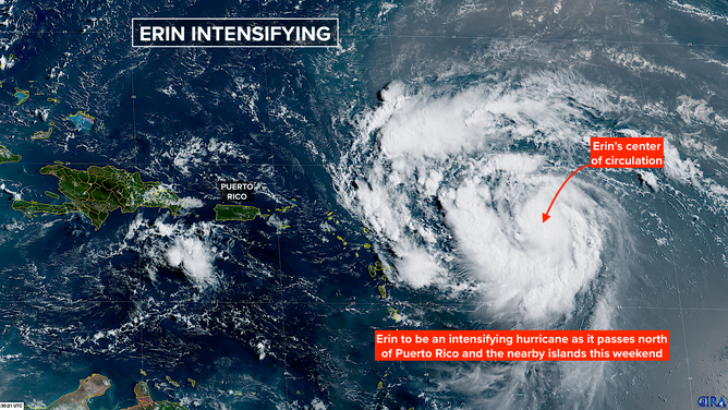
This graphic shows satellite imagery of Erin.
(CIRA / FOX Weather)
As the storm moves by the islands tonight and through the weekend, winds on the south side of the circulation could reach tropical storm strength – 40 mph or stronger. Tropical storm watches are in effect for the northeast Caribbean, and gusty squalls are likely on Puerto Rico and the Virgin Islands as well.
Remember that the winds and rainfall on the mountainous terrain will be greater than that at sea level. Squalls and bands behind the storm might produce the strongest gusts. Flash flooding and mudslides in some areas are possible, especially on the south and east sides of Puerto Rico, where the moisture-laden winds are onshore. Maximum rainfall amounts up to 6 inches are forecast.
Everybody in the islands should watch for alerts issued by the National Weather Service in San Juan.
HOW TO WATCH FOX WEATHER
The weather looks likely to deteriorate in the southeastern Bahamas on Sunday, spreading up the island chain Monday and Tuesday. Only fringe effects from the hurricane are expected, but extremely strong currents, large waves, and extra high tides are likely. Residents in the Bahamas should stay in close touch with the latest forecast over the weekend to be sure that Erin doesn’t swing wide and come closer to the islands than is currently expected.
All available credible evidence points to Erin paralleling the US East Coast well offshore – far enough that weather impacts along the coast should be minimal. The storm will grow in size as it moves north, however, which will produce strong swells moving toward the coast. Dangerous beach and boating conditions are likely.
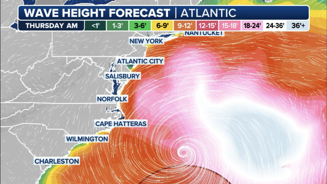
This graphic shows expected wave heights next Thursday, August 22, 2025.
(FOX Weather / FOX Weather)
Energy radiating from Erin’s circulation looks likely to impact Florida’s East Coast north of Palm Beach County and the Southeast coastline below Cape Hatteras on Tuesday. The peak impacts look to be from the Mid-Atlantic to New England late Wednesday and Thursday. High tide Thursday morning could be higher than normal with more powerful waves pounding the coast. Obviously, the timing could change as things develop next week.
The National Hurricane Center will analyze the size of the storm, the distance from the coast, Erin’s strength, and its forecast track to predict which parts of the coast will feel the most impact from the wave energy Erin produces. Those forecasts will come out well in advance of any significant coastal effects.
Large and strong hurricanes even a few hundred miles offshore produce significant and dangerous coastal impacts. Some good news, however: the timing on the storm should have it moving well away from the US East Coast by the weekend.
DOWNLOAD THE FOX WEATHER APP
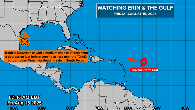
This graphic shows an overview of tropical activity in the Atlantic Basin.
(Bryan Norcross / FOX Weather)
In the Gulf
The tropical disturbance tagged Invest 98L will move ashore today near the Mexico/Texas border. It still has a chance of developing a circulation and being designated a tropical depression or Tropical Storm Fernand, but the main impact will be heavy rain. Flash flooding is possible in South Texas, especially in the Rio Grande Valley east of I-69C.
The tropical moisture will move into south-central Texas as well and linger into the weekend. Stay aware of any alerts issued by the National Weather Service.
Next Up in the Atlantic
There is some evidence that a disturbance moving off of Africa this weekend could develop. About a week from now it might be in the vicinity of the Caribbean islands and bear watching.
Some computer forecasts show it developing and others show nothing. As always, forecasts for systems that haven’t yet developed or even moved into the Atlantic are suspect. But that’s the kind of system we look for this time of year.